Cave Springs

July 1, 2018. We woke up early to beat the heat and managed to get to the trailhead for Cave Springs around 9am, although it was already hot and sunny. I got the sunscreen out so that I could apply it to everyone before we actually started our hike, but we were instantly swarmed by gnats as soon as we left the car. They weren’t biting bugs, but they were everywhere and they really wanted be around us. So I smeared a bit on Auggie and we took on down the trail as fast as we could to keep away from the bugs. I applied the sunscreen to the kids one limb at a time while we were walking.

The first thing we encountered was an old cowboy camp preserved under the rocks. The settings on my camera had somehow gotten all mixed up and it overexposed everything, but the bugs were swarming so badly that I had a hard time fixing it; I couldn’t stay still long enough to fiddle with the buttons.

We stuck around for only a couple of minutes because the bugs were so bad. Next on the trail was the spring in the cave of the Cave Springs trail. There were also old pictographs on the wall.

Next was a ladder up to the top of the slickrock and the gorgeous views topside.

The Cave Springs hike was beautiful but short, leaving us with plenty of time to do another one. So we ran back through the swarm of gnats, went back to the car, and headed onto Pothole Point.

On the way, we stopped off at a viewpoint of the Wooden Shoe Arch.

Pothole point is an easy hike over some slickrock, with nice views of the Pinnacles. Unlike Cave Springs, there’s no significant water source, so it’s a much drier, hotter walk, but not bad if you avoid the middle of the day.

The first part of the walk is up some gradual hills.

Eventually, you arrive on top of some slickrock, and get some beautiful views as well as some interesting rock formations.

The “potholes” are areas with dirt in the slickrock. During other times of the year, I assume that they collect water.

And, of course, some beautiful views of the Pinnacles.

At that point, we had mostly exhausted the list of “easy” hikes in the Pinnacles part of Canyonlands. It sounds like there are some pretty amazing hikes out in the Pinnacles, but they are too long and involved for the three kids, especially with a toddler in the hiking backpack. And Canyonlands is so enormous with huge geographic barriers separating the different parts of it that it was not practical to try to visit the other sections of the park for a day trip. So we went back to the campground to relax and hole up in the shade during the heat of the day.

That night, we experience another amazing night sky. Long after the sun went down over the horizon, and long after the sunset, you could still see the remnants of its light, with few stars in the west until those remnants were gone. And then we saw a sky full of amazing stars. I used a constellation app on my phone to identify them; there are so many more stars than what we are used to (what almost everyone is used to) that it was actually hard to figure out which stars go with which constellation. 

Eventually, the bright light of the moon started rising over the horizon and the starlight show was over.

Canyonlands

June 30, 2018. On travel days, we normally don’t have time to do much more than drive, get fast food for lunch inside the van, and unpack when we arrive at the campsite. But Canyonlands is only a couple of hours from Arches, and the Arches campground has a 10am checkout time. Unfortunately, that had us arriving right at the beginning of the hottest time of the day.

Canyonlands is a huge national park, but it’s separated into three pieces by geographical features that make travel between these regions impossible by car unless you drive out of the park and around. We stayed in the Needles region, which isn’t as popular as the Island in the Sky, which is closer to Arches, but it’s not as remote as The Maze, which doesn’t have any established campgrounds. The campground in the Needles is reservable, which is a big reason why I picked it. First-come-first-serve campsites are too stressful when traveling with three kids.

Our campsite in the Needles was great. It was huge, partially shaded, and had a gorgeous view. Although we had neighbors on either side of us, the site was large enough and situated so that they weren’t visible at all to us. It was basically the five of us alone in the middle of the Utah desert.

There was a downside, however. The nearest bathroom was a pit toilet that was at least a quarter mile away. The nearest bathroom with running water was 0.4 miles away (I checked on the van’s odometer). We used the bikes to go back and forth from the bathroom, and we used the van to drive there to drop off our grey water after doing the dishes since walking a quarter mile with a sloshing shallow container of gross water is not my idea of fun.

After we set up camp, we drove back to the visitor’s center. The kids picked up their Jr Ranger workbooks, and I asked the ranger for recommendations on hikes and things to do in the heat. Unfortunately, there wasn’t a whole lot. We got a couple of recommendations for hikes to do the next morning, and we found out where the local camp store was, but there weren’t any nice long scenic drives to take in the area where we could have stayed in the cool AC of the van that afternoon.

There was, however, a shorter drive of a couple of miles with an area at the end with some pretty spectacular rock formations. So we took it and I popped out to grab some pictures while the rest of the family stayed in the car.

Afterwards, we decided to check out the local camp store and see what sorts of things that they had. It was located just outside of the national park and basically consisted of a couple of trailers. They have showers there but no laundry. All their water has to be trucked in since they are completely off the grid, and the nearest town in a 45 minute drive away. You could also apparently buy internet access from them, although we didn’t try it out. It was super rustic and charming and low key and definitely appealed to the hardcore backpacking crowd. They also offered the kids free otter pops every time we went there. Super nice people, although their selection of food was pretty awful. Lots of really overpriced junk food and processed stuff that stores well.

We didn’t actually need anything from there and had mostly gone to kill time during the afternoon heat, so we went back to the campsite and hung out the rest of the day in the shade.

Canyonlands is located in one of the most remote places in the US. The closest town was, as I mentioned before, a 45 minute drive. The bathrooms, even the one with flush toilets, don’t have any lights. Our neighbors, although allegedly existed, were not visible from our campsite, nor were any lights that they might have had. So basically this probably the darkest corner of the planet that I’d ever visited before. Unfortunately, we were also there during a full moon (or close to it anyway), but there was about an hour between the sun setting and the moon rising when the skies were absolutely blazing with starlight.

I had downloaded an app on my phone that allows you to point up at the sky and learn what constellation you were looking at. It was a bit difficult to see, however, because the app assumes that you can’t see as many stars as we could see. It was an amazing light show and worthy of the trip in and of itself. My only regret is that we didn’t somehow manage to spend more time there on a moonless night. Next time!!

My clearest memory was looking off on the horizon and spotting a strange light. At first, I thought that maybe it was the visitor’s center that we had gone to earlier in the day. But the visitor’s center is farther away and not in that direction. It was clearly not a star; its light was more golden with a hint of orange. Then we thought that maybe it was an airplane flying directly at us, explaining why it was rising in the sky instead of going across it. But eventually it occurred to us (and confirmed with my app) that it was the planet Mars.

Of course, I’d seen Mars before in the sky, but it always just looks like a bright star to me. It’s supposed to be reddish, and maybe it was if I squinted enough and knew what I was looking for, but it never seemed all the different than the other faint lights in the sky making up the rest of the stars and planets. But that night in Canyonlands, it was super clear that Mars was nothing like a star. And its color was unique and different than any other object in the sky. The Milky Way is, of course, spectacular, but Mars is what I will always remember about the night skies in Canyonlands.

Double, Windows, and Turret Arches

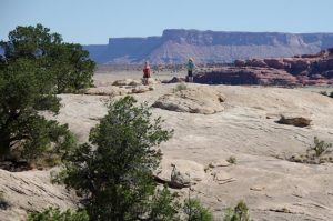
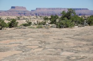
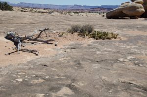
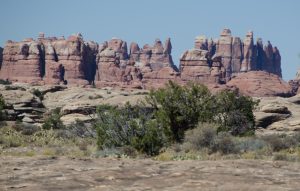
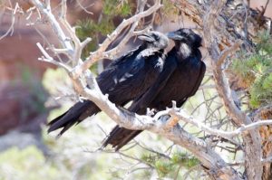
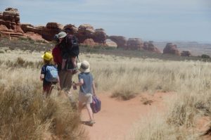
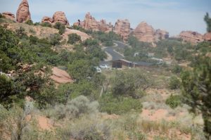
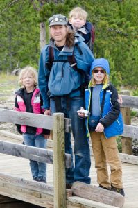
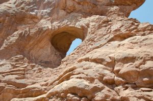
June 29, 2018. We started off our second full day at Arches at an area that has easy hikes to four different arches: Double, South Window, North Window, and Turret. All four of them also had the added bonus for the kids of having spots for them to scramble over lots of rock.

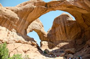
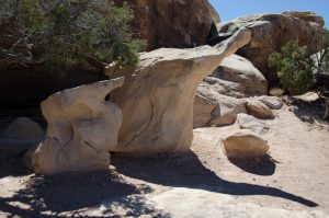
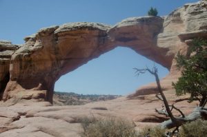
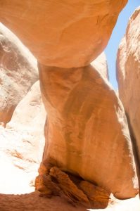
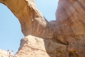
Double Arch was first. Pretty freaking amazing, right? I don’t even mind all the people in the photo so much; they do a good job of giving the scale of this arch (arches?). It’s a relatively easy scramble to get under the first part of the double arch. Aaron was even able to do it with Auggie on his back… and Auggie’s getting pretty heavy these days, so this is not an unimpressive fete.

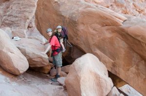
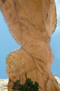
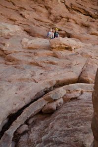
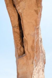
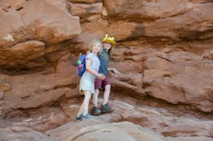
The second part of the arch is a bit more a scramble. Gigi seemed like she was about ready to attempt it, but I discouraged her… going up a scramble is lots easier than coming down one, and it was pretty steep. This is about as close as we got.

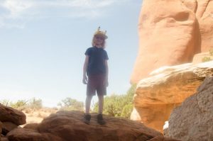
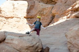
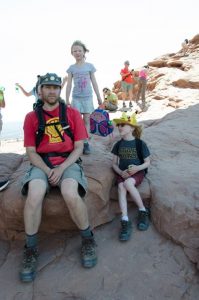
So, instead the kids climbed one of the walls off to the side of the arch. And, yes, my heart was a bit tight in my chest watching them climb so high, but it was an easier climb than it looks like in this picture. I did keep telling them to slow down and take their time. There was an even higher perch that some other people climbed up to, but I didn’t let the kids go up to that one. Time to go to the next arch, kids!

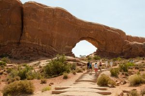
Next was North Window. This was a pretty popular hike with lots of people around, and there are stairs to make the journey easier.

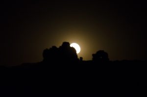
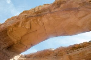
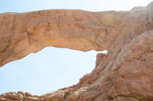
We had gone to a ranger talk the night before at the campground amphitheater, and, during his talk, he had mentioned that one of his favorite things is to lay down under an arch and take a look at it from that perspective. He also said that the Windows arches are one of the best places to do this. So I thought of him while I laid under North Window and took this picture.

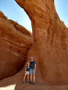
Aaron and the kids also enjoyed a break in the shadow of the arch. No, those are not Auggie’s arms growing out of Aaron’s head. He just hidden in the backpack behind Aaron.

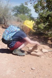
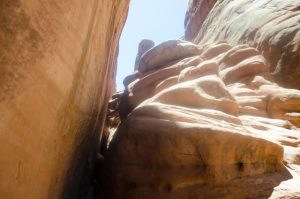
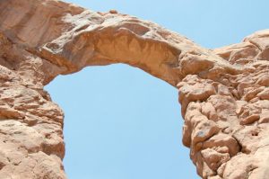
Next up was South Window. Maybe we just got lucky in the timing or something, but it was pretty empty. I guess people make the trek up to North Window and then figure they are done for the day? In any case, there was maybe one other small group of people there with us. After all the people around Double and South Window, it was blissfully peaceful.

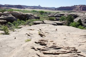
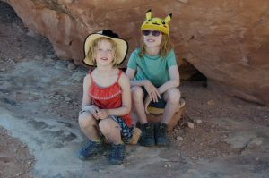
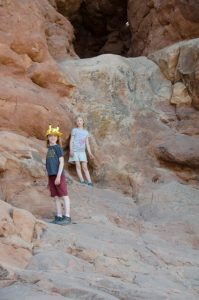
The kids had plenty of rock scrambles all to themselves, and I never get sick of these closeup views of the arch.

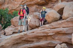
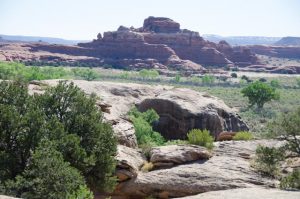
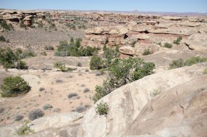
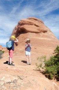
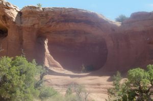
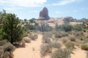
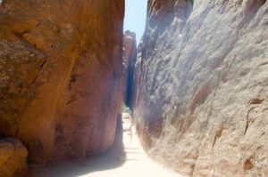
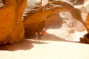
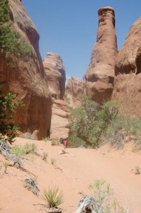
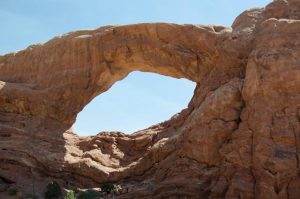
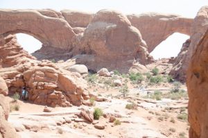
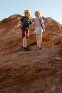
Turret Arch was next. It’s located just opposite of the Windows arches, so you have great views of one from the other. It was a bit more busy than North Window, but not as busy as South or Double arches.

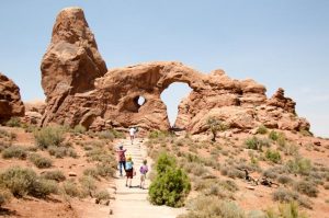
There’s a bit of a scramble if you want to make it to the top. Aaron wasn’t able to do it with Auggie on his back, but the kids and I went up there, and, once you get up there, it’s a great area for the kids to practice their scrambling. Plus there’s a fantastic view of both Window arches if you are in just the right spot.

After Turret Arch, it was starting to get close to Noon, which is time for a siesta in Southern Utah; the hottest time of the day is usually between about noon and 5pm, so it’s best to find somewhere to rest in the shade or air conditioning while it’s in the mid to high 90s in the sun (at least when we were there). While planning the events for the day, I saw there was a dinosaur museum outside of the nearby town of Moab. In my mind, I pictured a nice air conditioned building with some exhibits that the kids might enjoy and maybe even learn a few things while we avoided the afternoon heat. The reality turned out to be quite different.

The first sign that something was off was that the very large parking lot was almost empty. It was obviously open (we did see a few people), but not as many as I would expect in the height of the summer tourist season. Aaron dropped me and the two older kids off; we was going into Moab to run some errands while we stayed at the museum. We walked inside and went up to the ticket booth. There was no one there. Hrm.

While we wanted for someone to show up that we could give money to, I looked at the pricing on the wall. There were several categories of tickets with the cheapest one apparently not including the stuff inside. So a bunch of the museum is outdoors in the baking hot heat, which is exactly what I wanted to avoid. There was some stuff inside… maybe it would still be okay.

A guy finally showed up, and I asked him for three tickets: an adult and two kids for the “deluxe” package that includes the inside stuff. But as I was getting out my credit card, I noticed that there was a “family” price that was a bit cheaper (maybe $5 or $10) less than what we was charging us. So I asked him if I could get that family price instead. And then I had the weirdest conversation in which he told me that the family discount required two adults. We needed more people to get the cheaper family price. I said that my husband might be eventually joining us, but that he was running some errands. Apparently that didn’t count. The whole thing felt really weird and awkward and, when it came down to it, horribly expensive for a largely outdoor museum. So I gave into that gut feeling I had, apologized to the kids, and hustled them both out of there and called Aaron to come get us.

The ticket guy followed us out the front door. After making my decision, I wasn’t in the mood to be talked into anything, but he just grabbed a pack of cigarettes out of his pack. It was a great family place, let me tell you! Luckily, Aaron had been taking advantage of their free WiFi in the parking lot, so hadn’t gone anywhere. Once we got in the car, I explained to the kids why we weren’t staying there. Gigi, in particular, was pretty confused and had been looking forward to it. But they seemed to understand after I talked it over with them. And the more I thought about it, the more weirded out and angry I got over the whole thing… single parent families apparently have to pay more than two parent families to enter a freaking museum? How crazy is that?!

So we all drove into Moab instead, and I had Aaron drop us off on the main drag where I introduced the kids to the joys of frozen yogurt in a lovely air conditioned restaurant. Putting bits of chocolate and M&Ms and sprinkles into your ice cream? That’s the best thing ever! Afterwards, we walked down the street and found a bookstore. When I asked the guy who worked there where the kids section was, he smiled, pointed towards a back room, and told us to stay as long as we wanted. Small book stores are the best. Sadly, this was the only one we encountered during our entire trip… they are a dying breed.

The kids immediately gravitated towards the sequel to Dragons Love Tacos;  they curled up on a spot on the floor and started reading it to each other. I browsed the young reader shelves in the hopes of finding something a bit longer for Des that he might enjoy, but, being his contrary self, he refused to consider any of my choices. Gigi, however, piped up: Can you pick out a book for me? I want a book!

So I found Captain Underpants. Shorter than the books I’d been scoping out for Des, but I figured it would be an easy introduction to chapter books that she could read on her own. Of course, as soon as we got back to the campsite later that day, both kids read it from cover to cover at least twice, Desmond having apparently changed his mind about the merits of reading.

After the bookstore, we continued our walk down Moab’s main drag. It was a good time for a snack or maybe an early dinner. So I found a nice-looking spot with air conditioning and pizza and sent Aaron a text. He had finished his errands by then, so he and Auggie joined us shortly after we got a table, and we decided to go ahead and had dinner.

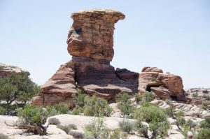
When we headed back to the van afterwards, we spotted a Hawaii license plate, getting one of the last ones on our list. And then we headed back to camp. It was after the hottest time of the day, but it was still pretty early with plenty of light left, so we decided to stop at Balanced Rock. It’s right off the road, so the path around it is more of a stroll than a hike, and the kids didn’t complain (very) much.

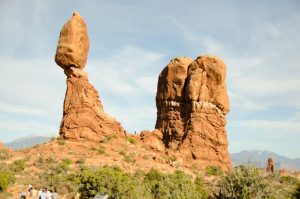
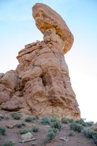
One thing that I didn’t get a picture of that I really regret is all the people at Balanced Rock taking pictures of each other. It seemed like there was a memo going around that I didn’t get describing the proper way to pose by holding up your palm flat to pretend that you are actually holding up the rock. At one point I looked around and there were at least four people (of different parties) posing this way at the same time.

And that was finally the end of our big long second full day at Arches. I loved the morning hikes and the beautiful campground, and I fully plan on going back someday when we don’t have a two year old in tow.

Our First Arches Hike

Since we’d gotten in so late the night before, we had a late morning waking up. We set up camp a bit better, had some breakfast, and decided to do our morning hike at the trailhead located conveniently just a couple of campsites away from us. Morning hikes are essential at Arches in the summer since it gets blazing hot during the day. You basically want to be chilling somewhere in the shade from about noon to four, at least, if not longer.

So we started out at Tapestry Arch, which is only about half a mile from the trailhead. It’s a pretty easy hike, but it does require a bit of scrambling over so-called slickrocks, which I imagine really are pretty slick during a rainstorm, but which are pretty easy to climb on a hot, dry day.

We saw lots of cool cacti and yucca plants around the trails, eeking out an existence in defiance of the hot, hot sun.

We followed a trail of stone cairns that showed us the way. This is particularly useful when walking up on the slick rock. Without the cairns, it would have been pretty impossible to figure out the right way to go.

After a short bit, we arrived at Tapestry arch, and I had a good time looking up at the arch above me and taking pictures. Des, Aaron, and Auggie needed to go back to camp for a potty break, so it was just Gigi and I exploring Tapestry arch up close. Another family got there about the same time we did, so we took turns taking pictures of everyone for each other.

Next, after going back to camp for a water break and a rest, we went back to the trailhead and went after Broken Arch, which is a little less than a mile away. Des really liked the idea of rebuilding any cairns that we found scattered (he’s all about constructing stuff), and the two of us got behind the others while he spent time rebuilding a whole bunch of them.

Broken Arch is so named because the top looks a bit like it’s broken into two pieces. This is a bit of an optical illusion; it only looks broken from some angles, but it’s really not, as you can see from the picture below. It just has this weird twisted shape. Anyway, we had a good time climbing down through it (it’s a bit of a scramble); the trail to the next arch, Sand Dune arch, starts after climbing through Broken Arch.

The trail from Broken Arch to Sand Dune arch is only a very flat mile, but it’s a brutal mile in the sun; there’s no shade. At first, there are some cool rocks to wind around and look at as well as some neat lizards.

(Am I crazy? Who does the rock in the picture above look like to you?) After that, it’s just a brutal field filled with scrub. A trivial walk in 70 degree weather, but it’s a lot different when it’s 95 degrees and very little wind. This was also getting later in the day, so close to that noon time when you really need to slow down and take a break.

(I later discovered a big fingerprint on my camera lenses, so, unfortunately, all my photos from this hike seem a bit hazy in the middle. Curses!) Sand Dune arch is actually really easy to get to from a car. You can basically drive up and park next to its entrance. So there were a whole lot more people there than at Tapestry or Broken arch. It’s pretty cool, though. You walk up to the arch through these tall fins.

The arch itself is, aptly, in the middle of a bunch of sand. The whole area is just really cool to look at, especially if you had any talent or desire to do some climbing on slickrock.

Afterwards, we walked back to camp. The second time through the open plain area was just brutal. We didn’t have to talk all the way back to Broken Arch; instead, we took a second passage through some other rocks back to camp. It had just hit noon, and the sun was brutal.

The hike itself was fairly trivial, but adding on the sun made is very intense. I was really happy to make it back first to the trailhead and then to camp.

Afterwards, we had a bit of lunch. Our neighbors came by and borrowed a mallet to stake in their EZ-up. Later, they offered to buy some ice for our cooler for us since they were driving to Moab, but we had already decided we were going into the visitor’s center after lunch. Moab was a short drive from there. Just in case, we exchanged phone numbers; the reception at our campsite wasn’t good, but we could get a single bar of 3G if we were lucky… enough for texts, anyway.

We went to the visitor’s center, got Gigi’s (new) passport book stamped and then went onto Moab to buy some ice and a few other things at the store. We actually ran into our neighbors there, which was kinda cool, and then they knew they didn’t have to get ice for us. When we headed back to camp, we discovered our poor EZ-up had become a victim to Arches’ sometimes brutal winds.

The camp host came over, looked it over, and said: Yup. We generally lose about 10 of those things a week. The wind just does a number on them. Luckily, we had a second structure, and we didn’t really need two now that we were past the rainy section of our trip (probably!) but we had learned caution from our experience, and we didn’t leave it up when we left camp after that.

We were not the only victims to the storm. Some other neighbors came by as well as borrowed some Gorilla tape to repair their tent that had ripped during the wind gusts. We apparently are prepared for most anything at this point. And we really were, although we did have to borrow a tool from our first neighbor in order to get the mangled EZup apart so that it would fit into the dumpster. (No easy recycling of steel, unfortunately. Recycling in general is not great at the national parks.) Aaron made sure to pick up a similar tool on the next trip to Moab the next day. His tool box will not be defeated again.

Salt Lake City and Getting to Arches

After our battery incident with the van in Glacier, Aaron decided to invest in a solar trickle charger. Rather than try to find one at a local spot while driving through, we decided to order one through Amazon while we were briefly in cell phone range while we were in Moose in Grand Teton park. Salt Lake City had a locker at a 7-11 where we could pick it up.

After stopping at a Walmart near Box Elder to pick up some supplies (easy place to park the trailer!), we went into Salt Lake, which was on our way anyway. It turned out to be hard to make a left turn into the parking lot, so we had to make a little detour for a better position getting into the lot. In the process, we went down a side street with large speed bumps. Bump! Bump! Ooops… after one of the bumps, we noticed our A/C stopped working. Then we noticed our engine temperature was MUCH higher than it was supposed to be.

After getting to the Sev, we stayed in the parking lot for a bit, hoping to cool things down, but that only made things worse. It was too hot to check oil or water levels, so we continued on cautiously. After a bit, the engine temperature went down again and all seemed well. We started thinking that there was an oil leek causing the problem. (Later on we discovered it was actually a faulty relay that was preventing our engine fan from turning on and off properly.)

In any case, we continued onto Arches without any other issues, and the engine temperature remained normal. We had a late start and weren’t scheduled to get in until after 9pm, but then we relied on Google too much. When Aaron turned off the main highway to take the smaller road to Arches, we instead discovered a dirt road. This definitely did not look like the right way. It turned out that Aaron had put “Devil’s Garden” into Google Maps instead of “Devil’s Garden Campground,” and this made a large enough difference to put our navigation off by a bit. Ooops! We backtracked and found the correct exit about 15 minutes behind us. Add in another rest stop break and we got into Arches at around 10pm, way later than we’d have liked, but at least we made it in one piece.

This was a view from a rest stop about an hour out of Arches. Beautiful country!

The Journey to Utah

We had a mysterious disappearance at Grand Teton. Somehow Gigi’s Jr Ranger passport book that she had had stamped at Glacier and Yellowstone and Colter Bay disappeared along with a couple of stickers and a magnet (also purchased at Colter Bay). Although I put it in the van right before our Colter Bay hike, we somehow lost it. So that was sad, and we spent a bit of time in the morning driving back to the Colter Bay visitor’s center (the opposite direction of where we needed to go) to see if anyone had turned it in and to buy another one when the original hadn’t shown up. So Gigi’s going to have to go back to Glacier and Yellowstone someday to get her stamps again.

After that, we took off for Utah, going first through lots of Wyoming followed by Idaho. Not a lot to say about this journey except that it was very lonely. I’m not sure if it was the particular route that Google sent us on, but the road was very empty and civilization was nowhere to be found. We’d finally left all hints of rain and coldness behind, and the weather was hot and dry and the sun relentless.

We found a playground in some small town in Idaho to regroup and have a wiggle break. Auggie found a kid about Desmond’s age to follow around on the playground and go down slides with him. He loves older kids, but is highly suspicious of kids his own size.

When we were on our way to our next campground at Box Elder, Utah, I was afraid it was going to be equally hot and dry, but the campground itself was nestled in between large trees and a little creek that ran right behind our campsite. The kids had fun scrambling down the bank to the water and walking across logs to get over the water. The water itself is shallow and unthreatening, even if they fall down in it. Basically a perfect place for kids to play.

Auggie discovered a friend; another two year old who was staying at an RV at a nearby site. It turns out that his grandmother was the camp host who lives there six months out of the year. She said that she always feels bad leaving for the winter, and I can’t say I blame her. The Box Elder campground is a little bit of heaven in that dry, deserty part of Utah.

Although it’s very secluded, it’s also very close to some significant population center and thus has great data access. I used our access point to catch up on the latest episode of the Expanse. So good! And it was a great place to update this blog.

Jenny Lake and Menor’s Ferry

The next day, we decided to explore some of the sites that had been recommended to us by the ranger from yesterday. The first on the list was a short drive on Signal Mountain, located conveniently near our campground, that supposedly had some fantastic views of the Tetons. However, when we got to the beginning of the road, there was a sign across it, explaining that the road was closed until 4pm while they cut down some unsafe trees near the road. They didn’t want anyone to get smashed in the process.

Next on the list was the Jenny Lake Overlook. On the way, we kept stopping to take pictures because… how could we not? There was a small turnout that explained about how the hard craggy shape of the Tetons was the result of glacier activity. Unfortunately, the glaciers on the Tetons were receding and may eventually disappear due to climate change.

There’s a small parking lot at the Jenny Lake Overlook, but we lucked into a spot. Jenny Lake is beautiful, and the view of the Tetons above it is pretty spectacular. We look a bunch of pictures and wandered around the outlook area. Auggie had fallen asleep in the van, though, and we didn’t particularly want to wake him up, so we decided not to seek out any hikes in this area, so this turned into a pretty quick stop in our daily adventure.

We got back in the car and finished the Jenny Lake scenic drive. As we were turning to get back to the main road, we went by the parking lot to actually go down to Jenny Lake and the hike recommended to most people not traveling with a 2 year old. It was so overflowing that people were parking out on the main road, which looked like it was a considerable distance to the action. No, thank you. I think we would have skipped that one even if we didn’t have to worry about Auggie.

Our next stop was Menor’s ferry on the Snake River, the site of an old homestead and ferry from back in the day. There are still a number of the original buildings remaining, many of them that had been built by Bill Menor himself, one room at a time. We looked through an album of at pictures from the time while a lady who worked there gave us a brief history. Apparently the man himself had a brother who built a house on the other side of the ferry, and the two of them spent many years pointedly not talking to each other. Brothers. Some things never change.

One of the old barns had a bunch of old carriages. Several of them had been used to transport people around Yellowstone before cars became popular. When the carriages were phased out at Yellowstone, they were purchased by local dude ranches who repainted them. A couple of them ended up here, still with the JY logo on them.

I don’t have a picture of it, but Bill Menor also built a storage building that he used to store vegetables with ice he cut during the winter. I’d really love to know how well that worked. The walls of the building looked pretty thick, but it does get really hot in that area. Did the ice last all summer in the storage building or just part?

Close to the ferry is an active Episcopal church called the Church of the Transfiguration. It’s a very beautiful, small building with the outstanding attraction of a large clear window at the very front that frames the Tetons. Since the building is so dark and the Tetons are so bright, it was hard getting a good photo, but here’s my best effort. There were also benches outside pointing, of course, at the Tetons.

After visiting the church, we drove to the visitor’s center at Moose where we enjoyed the air conditioning on the hot day and watched a video on the Tetons which was probably very interesting, except that I had a hard time not falling asleep listening to the soft droning voice and pleasant music.

There was also this crazy history of how the Teton park came into being; Albright, superintendent of Yellowstone, invited John D Rockefeller, Jr to the area and convinced him to buy up a lot of land in the Jackson Hole valley in order to donate it to the federal government and establish a park. So Rockefeller bought up a ton of land through some agents, but then had a really hard time getting the government to actually accept the land. Grand Teton was established as a park, but without Rockefeller’s lands.

Just as today, where there’s some local opposition to expanding Bears’ Ears in Utah, a bunch of locals didn’t want Teton Park to even exist, fearing federal government interference. Rockefeller actually had to threaten to sell off the land to someone else before Roosevelt turned the area into a national monument using the Antiquities Act, which really pissed off the locals. Then after WW2, the locals realized that the national monument was bringing in a lot of tourist dollars and maybe it wasn’t such a bad thing after all. So they struck a deal with the feds, and the national monument lands were added to the Grand Teton parklands while Wyoming got an exemption from the Antiquities Act; no more national monuments in Wyoming without congressional approval.

We took a short hike to a neaby site from the vistor’s center and encountered a deer who was totally and completely unconcerned about us.

Afterwards, we loaded back into the van and headed back to Signal Mountain, making a stop at the local camp store for ice for the cooler, ice cream sandwiches for the kids, and firewood to help keep away the bugs. We didn’t know it at the time, but it was to be the last campfire for quite a while; southern Utah, our next destination, had a ban on campfires due to dry, hot conditions.

Grand Teton Day 1

The only two nights of our entire 9.5 week trip that we don’t have reservations for were the two nights in Grand Teton. Turns out that none of the campgrounds (except the RV park) allow reservations; they are all first-come-first-serve. From reviews, the best campground is at Jenny Lake, but it’s a tent-only spot. The second best seemed to be Signal Mountain, which allows RVs up to 30 ft, but it’s almost equally hard to get a campsite. I read that your best shot is to get there by 10am, and that if you get there after noon, you are completely out of luck.

Grand Teton is adjacent to Yellowstone, so we didn’t have far to travel, but it still took a couple of hours to get through the park. This meant another very early morning since it usually takes us 2 hours to break camp. We packed up what we could the night before, set the alarm for 6am (actually getting up 15 minutes later), and sent the kids to hang out in the warmed up van to go back to sleep while we packed up our camp. Skipping breakfast and coffee, we almost managed to get out of there by 7:30 when Aaron discovered that the wire to one of the rear lights on our trailer had somehow been cut. Since I’m pretty sure it was working fine when we arrived, our best guess is that a squirrel or a chipmunk liked the way the wire tasted.

Luckily, while I had been hunting down a replacement battery charger in Helena for the one I had left behind in Portland, Aaron had been hunting down a crimper for the one that he had accidentally left behind. So he got it out and fixed the wire on our trailer light. After stopping for coffee and fuel, we were able to get out of Canyon at around 8am.

The journey to Grand Teton was really nice. In fact, if I could do it all over again, I’d skip the trip to Lamar Valley and just go south through the park. The herds of bison weren’t quit as big as in Lamar, but there were still plenty of them, and there were also lots of steaming super volcano stuff that I would have loved to investigate further. Next trip to Yellowstone, I’m definitely going to explore this area.

Finally, we left Yellowstone and entered Grand Teton and finally arrived at the Signal Mountain campground at just after 10am. Then we crossed our fingers and carefully made our way through the loop, looking for an empty spot. We looked up, spotting a campsite that someone had put a receipt for bear spray rental in the camping permit envelope that is supposed to tell you whether or not the camp is occupied or not. I took out the receipt and looked carefully, but it was for the day before, and didn’t say anything about the camp site. The site itself was empty except for a small old carpet that was only half visible in the dirt. Very odd, but the site was unoccupied, so we snagged it; it even had a driveway just big enough for our van and trailer. There is even a view of the Tetons if you look carefully enough through the trees.

Aaron disconnected the trailer and I took the van down to the campsite office to pay for the spot. I am very glad that I remembered to grab my checkbook because I don’t think I had enough cash, and the office was empty when I got there. Old technology sometimes still works.

I went back to the campsite and we took our time setting up camp and getting some brunch. I even cleaned out the van since it was looking pretty crappy after having practically lived in it for over a week.

After a bit of a rest, we went to the visitors’ center at Colter Bay and got Gigi’s Jr Ranger book stamped. A very helpful ranger told Gigi about all the different animals in the park and directed us to the Lakeshore trail, which is an easy 2 mile loop by the water. The view of the Tetons was spectacular.

The water was very high; it seemed likedly that the big storms we caught at Yellowstone were also here. Some plants and trees were by the lake’s edge were submerged. However, on that day, the weather was sunny and warm, a really great change from the cold, wet weather we experienced at Yellowstone.

Afterwards, we went back to camp, stopping to pick up ice cream sandwiches at the local campstore as well as some ice for the cooler. Grand Teton has been a relaxing change of pace from the craziness that was both Glacier and Yellowstone.

Lamar Valley and Grand Canyon

Friday night, it rained. It rained and rained and rained. And then it rained some more. I’m pretty sure there was also some hail mixed into it all. We were very grateful for our snug trailer. The kids also survived the night in their tent covered with an EZ up. Aaron had picked a good place for the tent, and it avoided the puddles that formed in other parts of the site. But it was very, very wet and cold.

We had heard that the place to see wildlife in Yellowstone was in a section of the park called Lamar Valley and that the best time to see them was before 9am or after 6pm. Since Lamar Valley was about 90 minutes from our campground, we woke up really early (Des and Auggie stayed in their PJs) and took off before 7. The nice thing about being out and about at that hour? There weren’t many people around.

So we got to pull over and enjoy the overlooks such as this one. Looks fake, right?

I also really like their “don’t fall over the cliff, stupid” signs.

See if you can spot the three bison in this photo. There were a lot of herds of them in Lamar Valley, but most of them you need some pretty strong binoculars to see.

Here’s another larger herd.

As we were watching another large herd in the distance through some binoculars, we noticed some other smaller animals mixed in with the bison. They were much lighter in color and ran around as quickly and agility as rabbits. I almost thought they were wolves at one point except that the bison were utterly unconcerned, and then I thought I glimpsed horns and long legs (the binoculars were not very high powered). Meanwhile, this guy snuck up on us. This is a closeup; he wasn’t actually this close to us, but still much more identifiable. Consulting our list of common Yellowstone animals, we figured out he was a Pronghorn Antelope.

We continued onto the end of the valley. There was a picnic stop at the end that we planned on using to have a bit of breakfast, but then we reconsidered when we saw how wet and cold it was. It was a lovely site next to a river, but just not very comfortable at that moment. So we turned around and went back through the valley.

We stopped at a pullover where there were a crowd of people staring at this cliff for big horned sheep with powerful lenses. Some of them were also looking at the other side at this river where they said they could see some antelope. I wasn’t able to see either; just some people walking further down into the river bed, looking for more animals. So we got back into the van and continued on our journey.

Next, we ran into another herd of bison that were holding up traffic by standing in the middle of the road. These two were just a car length ahead of us to the side of the road.

This picture was taken out our front windshield. The bison just stood in the middle of the street for a while, completely unconcerned with all the cars around him or the traffic he was holding up.

Afterwards, we drove back to our campgroud for some breakfast and, at least for me, a bit of a nap. It had been an early morning.

After a bit of a rest, we headed down to the visitors’ center so that Gigi could get her Jr Rangers book stamped. We looked at the exhibits for a little bit and then got back in the car (Yellowstone involves a LOT of driving) and drove down the road to the Grand Canyon of Yellowstone, the place that our campground was named after. Wow. I’m not really sure what I was expecting, but this was beautiful.

If we didn’t have a clumsy two year old with us, I would have loved to have hiked further along the canyon and explore all the different colors and textures in the canyon. But steep cliffs and a kid who doesn’t always stay close to us and isn’t old enough to have good safety judgements isn’t a great combination so we reluctantly left. And that was pretty much the end of our great Grand Canyon adventures. I would love to come back later when the kids are older and we can do some longer hikes.

Yellowstone Supervolcano

On our first full day at Yellowstone, we headed west and south from Canyon towards the Yellowstone supervolcano caldera. Our first stop was Artists’ Paintpots. The parking lot was a zoo, and we spent a lot of time waiting for the cars ahead of us who were waiting for someone to slowly pull out of their parking spot. The lane was narrow and one-way, so there was no passing someone who stopped. We lucked into a parking spot and started on the 1-mile Artists’ Paintpots loop.

At first, it was really pretty, but pretty normal foresty stuff that mostly consisted of remnants of a long ago forest fire with green new growth replacing it. And then we hit the first hot bubbling greenish-yellowish muddy spring with a geyser spouting off behind it. We were suddenly not in a normal forest anymore.

The path winds around the creek and up some stairs until eventually we had a view of the entire basin area and its totally bizarro alien surface. And yet, if you were to look the other way, you’d see that we were still, in fact, on Planet Earth, and there was still plenty of normal foresty stuff around us. It was just mixed up with all this excess energy bubbling up from the ground. The colors were beautiful and mixes of oranges and reds and blues and greens.

There was even a big spot full of white-grey bubbling mud that was really hard to photograph. The second shot shows the white-grey stuff and how it looks like it has just been dropped in the middle of this beautiful evergreen forest.

They built a boardwalk through most of this area since walking on the ground would not be a very good idea.

The next stop was just 5 or 10 minutes down the road from Artists’ Paintpots. Beryl Spring was name for its beautiful blue-green color. Super pretty. It basically looks like a giant natural hot tub. But one that would almost burn your skin off and be toxic to your health.

The next stop was Gibbons Falls, which marks the edge of the supervolcano caldera (from its last major eruption 640,000 years ago). Auggie had a lot of fun walking on the stones that lined the path and going up and down the stairs. Gigi and Des raced ahead to the end, meeting me as they were coming back from the end. “When can we go? Where’s Auggie? What’s a caldera?”

So I got out the Yellowstone map and showed Gigi where the caldera was supposed to be, covering about a quarter of the park. She asked me all kinds of questions about volcanos and craters and wanted to know why she couldn’t actually see the Yellowstone caldera. So many questions that I could only blindly repeat to her the answers that I had read. Yellowstone is still a pretty big mystery, even to experts, and my answers were less than satisfactory.

The kids were starting to get hungry at this point, and Auggie was getting grumpy and in need of a nap, so we decided to skip the next couple of stops and go straight to Old Faithful, which was as far south as we planned on going that day. As expected, Auggie fell asleep in the car on the way there, so he and Des stayed with Aaron in the car while Gigi and I went on an expedition for some lunch. We went into the HUGE gift shop, skirted the edge inside and went to the back where they had a small selection of cold, soggy, way overpriced sandwiches. But they would have to do, so I exercised my credit card and we took our dubious bounty back to the van.

Auggie was still sleeping after I finished my sandwich, so I left the family there while I went and scoped out the area. Although we had found the gift shop, the whole Old Faithful complex is so huge, that it’s not immediately obvious where exactly Old Faithful itself is. I eventually found it and, after overhearing some people talking, discovered that it was scheduled to go off in 15 minutes.

There was just enough of a phone connection that I could text Aaron the location and to wake Auggie up and join up with me. He texted back that he was on his way. And then I waited and waited and waiting. Old Faithful just kept looking like this. After not hearing from Aaron for a while, he finally texted again and said that Des had had an attack. We completed failed in the parent department that morning and forgot to give him his anti-seizure medicine.

So Aaron waited for Des to recover and then took both kids to the bathroom. Meantime, Old Faithful, which is supposed to go off within an interval of plus or minus 10 minutes, was 15 minutes late from her scheduled time. I waited and waited and waited some more. And then I spotted Aaron and the kids and waved wildly so they could see me. Which they totally didn’t. And then Old Faithful chose that moment to finally erupt. She had obviously been waiting for Aaron and the kids to show up. It was beautiful and impressive, but not actually my favorite thing of the day. The Artists’ Paintpots and Beryl Spring were just so cool.

I reminded Aaron that we had extra medicine for Des, but not an oral syringe, so we walked to the clinic (which was a bit of a distance, since the whole complex is just to big), explained the situation, and got a syringe for the nurse, who looked very relieved that we weren’t asking them to administer any medicine. As we walked back to the car, it started to rain. While I had been waiting at Old Faithful, there had bit a bit of lightning and thunder in the distance. It finally caught up to us. Luckily, we didn’t have far to go when the rain started, so we missed most it, but it was a pretty impressive storm that even included a bit of hail. But then it was over and quickly as it started, and the sun came out and it was warm again, all of a sudden.

Just in time for what turned out to be my favorite stop of the day: The Grand Prismatic Spring. At first, it looks like a very beautiful but otherwise ordinary river. But then you see this flowing into it. And then we saw this weirdness. And then further on the path is this gorgeous blue-green boiling hot pool that is apparently the site of the Excelsior geyser, which went off in the late ninteen century and then again once for a few days in the 1980s. Notice the little red dot on the screen. That’s someone’s hat that must have blown off. There was a whole collection of hats lying around and in the bubbling lagoon.

And then we walked further along the boardwalk and went squarely back into full, beautiful, alien territory. Words cannot do it justice. The story is that when the first white people who explored the area tried to tell people back East about this area, they were laughed at. “We do not print fiction!” was the reply to a memoir of one of these explorers. And I can totally believe it. Because it is something that really needs to be seen to be believed. These are just a few of my favorite photos.

After this stop, it was starting to get late, so we called it a day and headed back to camp. When we booked this trip, I was half-expecting that Yellowstone would be somewhat overrated, but it’s really, really not. I highly recommend it… furthermore, I’d skip Old Faithful and just spend time at all the other cool stuff that is much prettier and interesting than the big geyser.